

Start here
Why the Southwest Rewards Solo Travelers
Next
Understanding the Distances and Terrain
Then
Choosing Your Route and Anchor Stops
Important
Desert Safety Essentials
Final step
Building Your Itinerary
Why the Southwest Rewards Solo Travelers
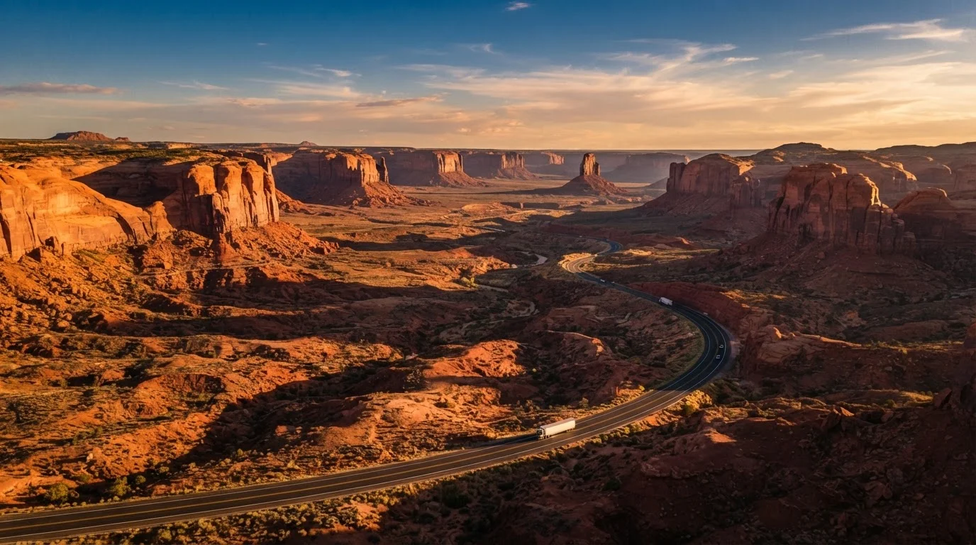
There are few travel experiences quite like pointing a car toward a horizon of red rock and open sky, entirely on your own schedule. The American Southwest — spanning Arizona, Utah, Nevada, and New Mexico — is one of the world's great self-drive regions, and solo travelers have particular reason to love it.
The region's highway infrastructure is well-developed, towns are spaced at manageable intervals, and national parks are designed around independent visitors. Without a group's competing priorities, you can linger at a viewpoint until the light shifts, leave a campsite at 5 a.m. for sunrise, or spontaneously add a detour down a canyon road. That freedom is the whole point. For a broader view of how solo travel changes your planning approach, see Solo Travel vs. Group Travel: What Changes About the Planning Process.
Make spontaneity part of the plan
The best solo road trips leave breathing room in the schedule. Booking every night's accommodation in advance can reduce stress, but try to keep at least one or two nights flexible — especially mid-trip. Some of the Southwest's most memorable experiences happen at viewpoints and trailheads you didn't know existed before you arrived.
Understanding the Distances and Terrain
First-time Southwest visitors routinely underestimate scale. The drive from Las Vegas to the Grand Canyon's South Rim is roughly 280 miles — nearly five hours with stops. Monument Valley to Moab is another three-plus hours. Spreading your stops too thin across a short trip leads to exhausting driving days with little time to actually explore.
The landscape itself introduces variables that don't exist in other regions. Desert elevations swing dramatically — Bryce Canyon sits above 8,000 feet, while the Colorado River runs through canyon floors closer to 2,500 feet. Those elevation changes affect temperature, road conditions, and physical exertion. Additionally, cell coverage disappears over wide stretches of Arizona and Utah, making pre-downloaded offline maps a practical necessity rather than a luxury.
Timed-entry reservation
A system used by busy national parks that requires visitors to book a specific arrival window in advance, rather than simply showing up at the gate.
Hoodoo
A tall, thin spire of rock formed by erosion, most famously seen at Bryce Canyon. The unusual shapes come from layers of rock eroding at different rates.
High-clearance vehicle
A vehicle with more space between its undercarriage and the ground, allowing it to drive over rough, unpaved terrain without scraping the bottom.
Offline map
A digital map downloaded to your phone or device so it can be used without an internet or cellular connection — essential in remote desert areas.
Slot canyon
A narrow, deep canyon carved by rushing water through smooth rock, creating dramatic, winding passages lit from above. Antelope Canyon near Page, Arizona, is a well-known example.
Rim trail
A hiking path that runs along the edge of a canyon or cliff, offering views into the canyon below without requiring a descent into it.
Choosing Your Route and Anchor Stops
A classic first-timer's Southwest loop connects a handful of signature destinations that each offer something genuinely distinct:
- Grand Canyon (Arizona) — The South Rim is one of the most recognizable landscapes on earth. Plan at least a full day, ideally two, to hike a rim trail and absorb the scale.
- Sedona (Arizona) — Red rock formations surround a small arts town with an unusually high concentration of accessible hiking trails. A good base for a night or two.
- Monument Valley (Arizona/Utah border) — The sandstone buttes here have been photographed so often they feel familiar — until you're actually standing in front of them.
- Zion National Park (Utah) — Slot canyons, the iconic Angels Landing trail, and the Narrows make Zion one of the most varied parks in the system.
- Bryce Canyon (Utah) — Hoodoo formations in shades of orange, red, and white. Even a short rim walk delivers extraordinary views.
These five destinations can be connected in a rough loop starting and ending in Las Vegas, which has the region's most accessible major airport. See our Travel Itinerary Planning from Scratch for help structuring your days between anchor stops.
National Park Service — Trip Planning
The official NPS site (nps.gov) provides up-to-date entry requirements, permit systems, and visitor alerts for every national park in the Southwest. Start here before finalizing any route.
Offline Map Apps
Apps like Google Maps and Maps.me let you download regional maps to your phone before leaving cell coverage behind. A must-have for driving remote stretches of Utah and Arizona.
Recreation.gov
The official portal for booking campsites, permits, and timed-entry reservations at federal lands across the Southwest. Many sought-after spots book out weeks or months in advance.
Desert Safety Essentials
The Southwest's remoteness is part of its appeal, but it demands real preparation. These are the non-negotiables:
- Water
- Carry more than you think you need — both for drinking and for vehicle emergencies. Gas stations in remote areas may be 80 or more miles apart.
- Vehicle check
- Before departure, verify tire condition, coolant levels, and that your spare tire is functional. Summer heat amplifies any existing mechanical weakness.
- Navigation backup
- Download offline maps (apps like Google Maps and Maps.me allow this) and consider a paper atlas as a last resort. GPS signal is generally reliable, but data service is not.
- Trip sharing
- Leave a detailed copy of your intended route — including campsite names and check-in dates — with a trusted contact at home.
Park rangers are genuinely helpful resources. If you're planning a backcountry hike, stop at the visitor center first; conditions can change and rangers have current information. Always verify entry requirements and permit availability directly with the NPS before your trip.
Summer Heat Requires Extra Caution
Midday temperatures in canyon country can exceed 110°F (43°C) in July and August. Hiking into or below canyon rims during midday in peak summer is genuinely dangerous, and rescues are common. If you travel in summer, plan strenuous activity for early morning and stay in shaded or air-conditioned locations during peak heat hours. Always verify current conditions with park rangers.
Building Your Itinerary
A workable Southwest itinerary balances drive time, rest, and meaningful exploration. A rough rule of thumb: limit yourself to no more than three to four hours of driving on any day that also includes significant hiking or sightseeing. A 10-day loop might look like two nights each at Sedona and Zion, one night in Monument Valley, two nights at the Grand Canyon, and one at Bryce, with travel days built in between.
Build deliberate buffer days into the schedule — the Southwest routinely produces unexpected magic, and the freedom to follow it is why you're traveling alone in the first place. For a complete end-to-end planning workflow that covers bookings, packing, and day-of logistics, the Complete Trip Planning Workflow is a practical companion to this guide. And if you want to understand what separates a smooth trip from a chaotic one at a structural level, The Anatomy of a Well-Planned Trip breaks it down clearly.
Frequently Asked Questions
A meaningful circuit covering major highlights — Grand Canyon, Zion, Bryce Canyon, Monument Valley, and Sedona — typically requires 10 to 14 days. Shorter trips of 5–7 days are possible but involve more driving and fewer stops.
Spring (March–May) and fall (September–November) offer the most comfortable temperatures for both driving and outdoor exploration. Summer can bring extreme heat, especially below-rim canyon areas, while winter may close mountain roads.
Most iconic destinations are reachable on paved roads with a standard vehicle. A high-clearance or 4WD vehicle expands access to unpaved backcountry routes but is not required for a first-time trip.
A commonly cited general guideline is at least one gallon of drinking water per person per day in desert conditions, plus extra for vehicle emergencies. Always verify current recommendations with local park rangers before hiking.
Many high-traffic parks, including Zion and the Grand Canyon's South Rim, use timed-entry reservations or permit systems during peak periods. Check the official National Park Service website well ahead of your planned visit dates.
With proper preparation it is a well-established way to travel. Share your itinerary with someone at home, carry emergency supplies, download offline maps, and always tell someone your plans before venturing onto remote trails.
The content on this site is for informational purposes only and is not a substitute for professional advice. Always consult a qualified professional for guidance specific to your situation.